


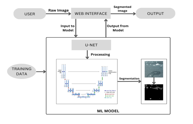
This repository represents a web app with a Binary classification ML model which creates a segmented images of plain land.
-
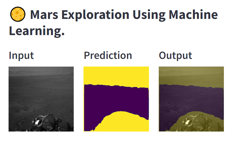
This project is developed ML model that segments plain land from input image on martian surface.
-
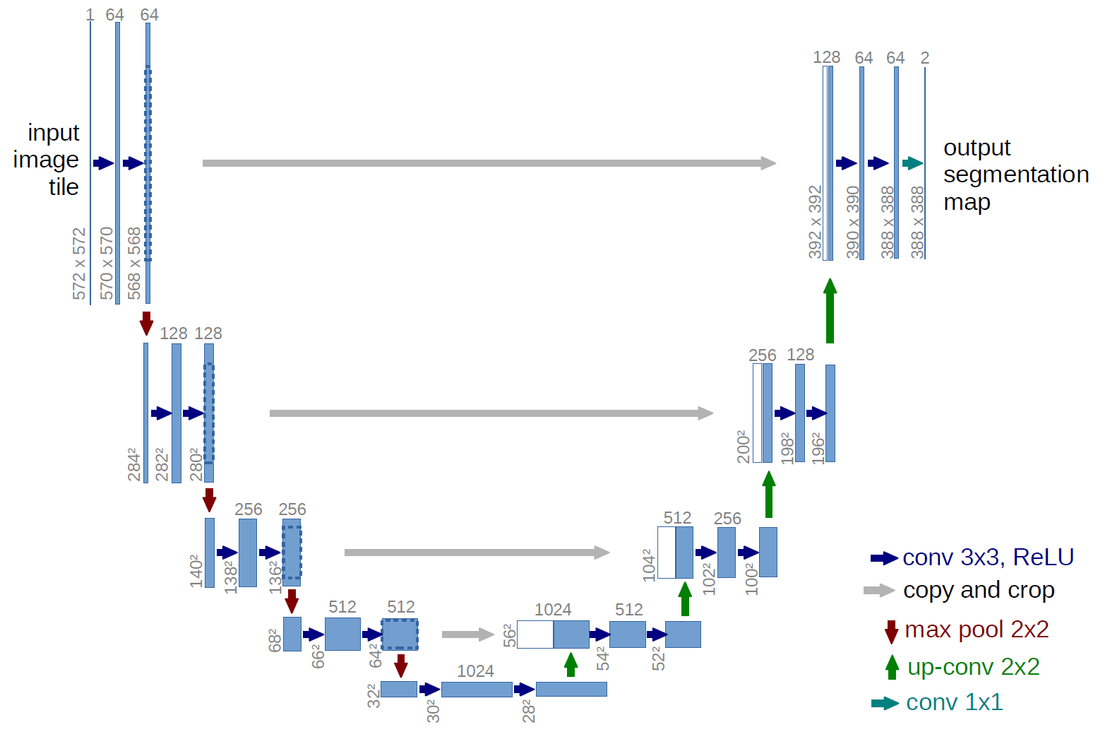
Implementation is based on the U-Net architecture which creates a segmented image from raw image as an input.
- 🟡 Yellow area - Danger 💀
- 🟣 Purple area - Safe 😀
- ai4mars terrainaware autonomous driving on mars from Kaggle.
- Python 3.10.9
- Tensorflow 2.12.3
- PIL 0.13.1
- OpenCV 4.6.0
- streamlit 1.28.0
- segmentation-models 1.0.1
- tensorboard 2.12.3
Rest of the packages are listed in packages txt file.
- Download the "MarsSegmentationModel_20230308-131105.h5" file from following Drive Link which is the real model file and used in app.py.
- new_app.py file uses quantized_model.tflite file which is quantized(small size) version of above h5 file link. Use new_app.py file which is lighter.
- app.py and new_app.py possess same architecture but different version of same model.
-
Install the dependencies locally.
-
To deploy this project:
streamlit run new_app.py-
It will launch the webapp, then follow below steps :
- Click on Choose File.
- Upload any file from Input samples eg IMG1.png.
- Enjoy the results.
| Hyperparameters | Values |
|---|---|
| Epoch | 20 |
| Batch Size | 16 |
| Learning Rate | 1e-3 |
| Optimizer | Adam |
| Scheduler | ReduceLROnPlateau |
| Accuracy | IoU Score |
| Loss Function | Jaccard Loss |
If you have any feedback, please reach out to us at coder.shrirang.kanade@gmail.com